


Where on this earth
A bird's eye view of adventure

If you’re new here -HELLO! I’m Natalie aka Yogi Magee and you signed up for this monthly newsletter on my website or through some other dark corner of the web. If, perhaps, you were forced to input your email address by a kidnapper or if you’re just tired, so tired, at the thought of receiving another one of these newsletters next month, you can always unsubscribe at the link at the bottom of this email no hard feelings…no feelings at all.
But I hope you stay, because I have some amazing content in store for you each month. Last month I talked about Instagram posing hacks, so you can get the most out of your photos. In this month’s free newsletter I’m going to talk about a tool I use to find some of the amazing spots and hiking trails I love. It’s free and everyone has access to it and it’s, in my opinion a highly under-valued research tool.
I’m talking Google Earth.
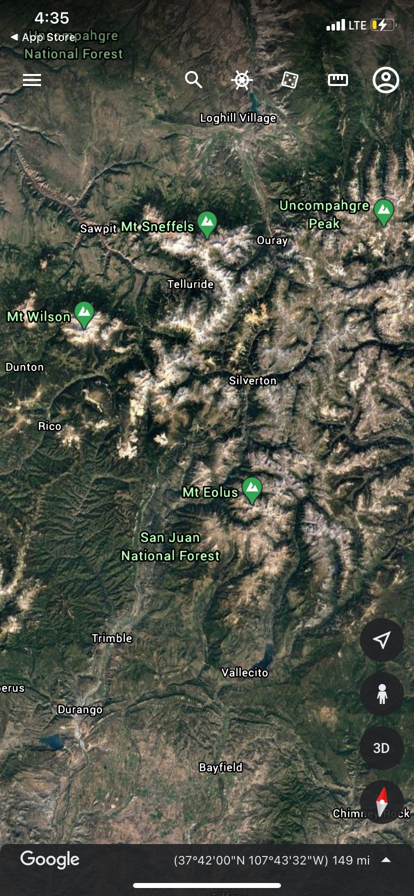
You can access google earth via your computer or the app and it will give you a topographic overview of specific areas. For this photo above I simply typed in, “San Juan Mountains, Colorado.” Then you’ll see a geographic overview and you can move around to different areas. Normally, what I do is find the lakes on the map and then I’ll zoom in and it will tell me what the lake’s name is if it has one. From there, I can type the name of the lake into google and start more extensive research. For example, some of the lakes may not be accessible except by bushwhacking 15-20 miles or the road to the trailhead is primitive. In some cases, you can only see the lake from the top of the surrounding peaks. Other times, there’s a clear trailhead or there might be a modest dirt road that a high clearance vehicle with off-road capabilities can reach like this one:
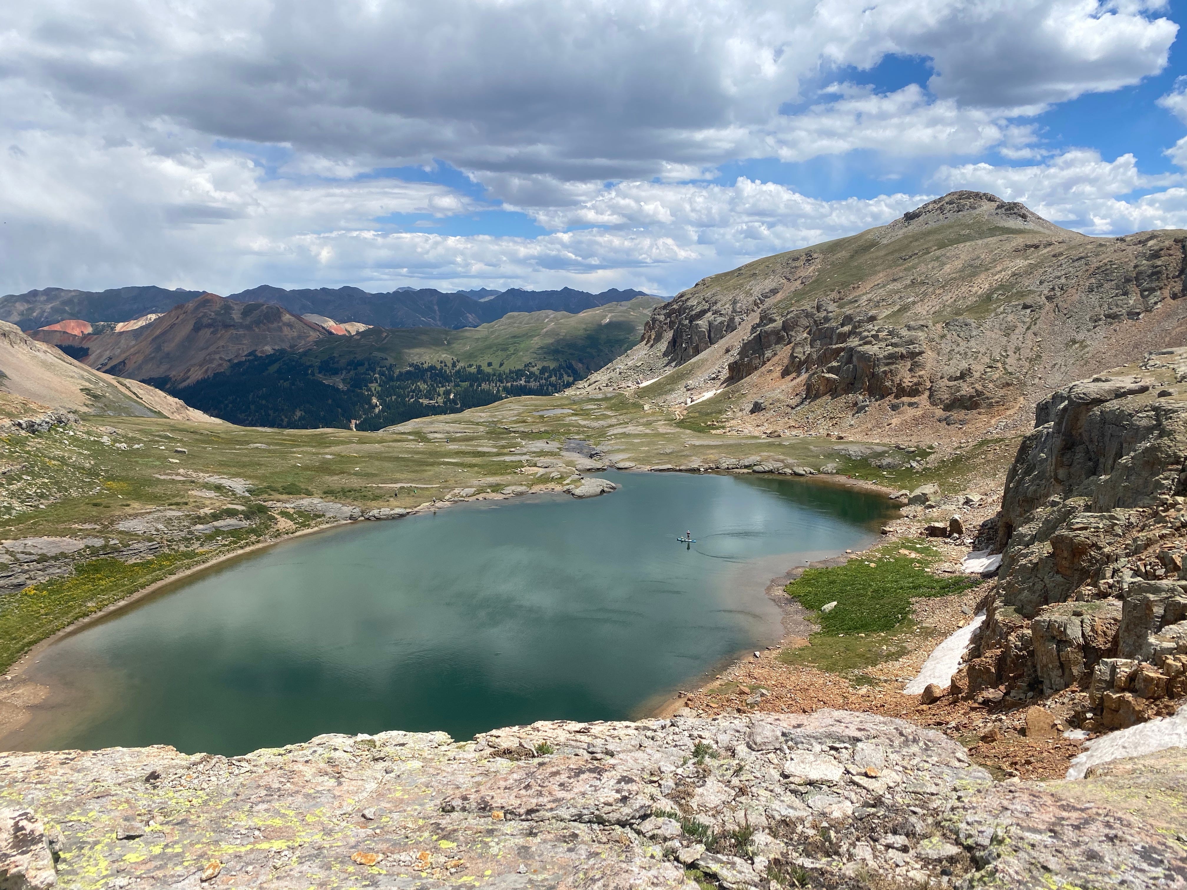
Yes, that’s me paddle boarding on the lake after hiking it about 2 miles up the primitive road!
We started using google earth when we bought our Can-Am side-by-side so we could see which roads were OHV-friendly. What we quickly found, is google earth is a wealth of knowledge if you know what to look and search for. It’s much easier to find canyons and caves, since flying over terrain provides a good way to visually locate waterfalls, rocky outcrops, sinkholes and slot canyons. Want to locate slot canyons in Utah? Just spend a few hours getting a bird’s eye view on google earth.
There’s an alpine lake I found a few years ago located in the San Juan Mountain Range of Colorado in which I had only taken the standard hiking trail to reach. The standard trail, which is what comes up on Alltrails.com when researching, has a lot of switchbacks and is a constant uphill grind. Using google earth, I was able to determine there were two alternative hiking trails to this lake that cut out the uphill grind and connected with the main trail.
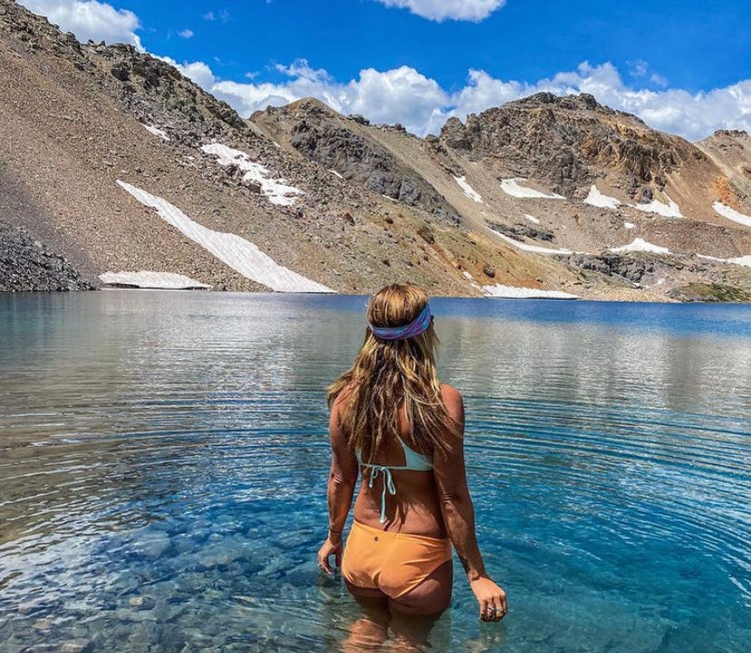
*No this isn’t Ice Lake Basin although the colors are very similar to Ice Lake!*
I held a retreat at the Opus Hut several years ago, which is how I originally found this lake. The Opus Hut website said there was a way you could hike to the lake from the hut (there’s your clue!), but I didn’t do enough research before the retreat, and we ended up driving to Ice Lake Basin. When I came back to this area with my friend, I dug a little deeper and found two alternative routes. You should have seen the other hikers faces when we connected with the main trail and shaved hours off our time and arduous climbing, and they were left scratching their heads asking, “Where did YOU come from?”
I know people who have used Google Earth to find hot springs as well, but I think a great resource is NOAA and the website categorizes thermals all over the United States and you can see the approximate temperature of each spring. There are lots of primitive hot springs in Idaho and I’m definitely putting that on my list for future expeditions.
If you want more information on my favorite hiking spots, especially as summer approaches, you can access my subscribers only email by signing up below. You can cancel anytime before your renewal date and you also have access to my archives. Or you can continue to enjoy the free content provided here and, armed with a few tips and tricks, have fun scouting adventures on your own or with your family. I always feel that, the more research it takes for a person to reach a spot, the more likely they are to keep it pristine for the next generation of adventure seekers.
I hope you enjoyed this month’s newsletter and if you’ve been here since day one, thank you for sticking around. We have a family trip to Monument Valley at the end of the month and I look forward to sharing all my travel tips with you in next month’s newsletter.

(Photo of me enjoying one of my favorite primitive hot springs this past weekend)
Great tip for hot springs with the NOAA site!!